About Us

The South Rift Valley region of Kenya where SORALO works spans an area of approximately 850,000 hectares (2,100,396 acres) covering a range of topographic and ecological conditions and hosts one of the richest large mammal assemblages on earth. The productivity and survival of wildlife and livestock in this area depend on a common ecological strategy rooted in mobility and feeding efficiency. This has made it possible for wildlife and pastoral livestock to co-exist for over 3,000 years without significant degradation of the environment. This area comprises of mainly arid and semi-arid lands, and unfortunately has a history of long-term marginalization and neglect, particularly by governmental policies and departments. However due to its rich culture, wildlife, ecology and landscape the potential for diversification of land use and livelihood generation, particularly through tourism, is high.

Area Map

Area Map

Tuesday, June 22, 2010

Enhancing Communication & Client's Facilities in Suswa

Mt. Suswa has well renowned lava tunnels (caves). It is considered to be the world’s most complex braided system of lava tubes. The Suswa Caves will be the main tourist attraction in the Mt. Suswa Conservancy. It has a Pre-historic occupation and a historic habitation by Kenyan Mau Mau fighters during the colonial era. It has ecologically important new insect species, rare bat colonies and habitation by carnivores such as leopard. Their ecological impact on the caves has been the source of many studies and scientific papers.

UHF System
Suswa Conservancy was established 3 years ago and is manned by 4 community game scouts, who underwent a 3 months training at KWS Manyani Field Training School. The area is facing wildlife poaching for bush meat, environmental destruction through charcoal burning, prevalence of human/wildlife conflicts challenges among others. The scouts carry out anti poaching patrols, monitoring and protection of endangered wildlife and mitigate human/wildlife conflicts in collaboration with the Kenya Wildlife Service, Forest Dept, Local administration, African Conservation Centre and any other conservation agency. Suswa is also visited by resident and international visitors who visit the caves and the calderas and do camping in the area.

Soralo has facilitated the installation of a Radio communication system and equipment at Mt. Suswa Conservancy on the 18th of June 2010 at Lkerengeti Base. The VHF Radio network will enhance tourist and wildlife security in the general Mt. Suswa conservancy. The radio network is also linked to kws stations in the area, Nairagie Nkare station which links to their other stations. This communication is intended to link Suswa conservancy with the already established conservancies like Shompole and Olkiramatian.


Eco-Toilets

The new Eco toilets built at the Suswa caldera view point site. Clients will now access sanitary facilities (bathrooms and toilets) that are in good condition. The Suswa caldera view point is scenic for both the outer and inner crater. The latter is a pristine forest composed of cedar trees and other indigenous species.


Mt.Suswa Caves

Maasai Culture

Among the recommendations of the settlers’ Land Committee that had been formed in 1905 and chaired by Lord Delamere, a well known Kenyan settler in Kenya’s Rift Valley Province, was to group Africans into definite reserves away from European settlers or any lands likely to be suitable for European settlement. The colonial government used the 1908 bill prepared by the protectorate authorities for the settlers’ legislative council, the Land Ordinance Cap. 113 of 1923 to take away large tracks of high potential land from Africans. The bill declared such lands to be public lands under the control and subject to the deposition of the Governor. Such lands were declared white highlands and the Africans were pushed into reserves Herren (1991), Wacker (1996) and Gitau (2006). The restricted white highlands were eventually subdivided into large farms and ranches, occupied by a low-density population composed primarily of white British settlers who mainly practiced extensive market oriented livestock farming.

At independence in 1964, the pastoralists and pastoral areas were only marginally integrated into the mainstream of the Kenyan economy. For instance, pastoral beef production did not find its way into the international market, as was the case with the agrarian producers. However, pressure from international donor agencies, which financially supported the pastoral development and basically developed the ASAL, had a major influence on the formulation of government policies. This resulted in formulation of the group ranch policy modeled along the US ranches and supported by the World Bank financed Kenya Livestock Development Project I (KLDP I). The project was implemented by the Kenyan government objectively to step up commercial off-take from pastoral areas and to secure land tenure in order to make such an increase of production possible. The group ranches, which were to be owned by an identified fixed group of people with a fixed territory was seen as the way to stop the “tragedy-of-the-commons” perceived as happening in African pastoral areas by administrators, planners and donor agencies alike.

The group ranches were to be run under collective arrangement by bona fide members of the group ranches. Under the legal framework as provided in the Group Representatives Act of 1968, the pilot group ranches were established in Kajiado District.
As indicated above, the push for the creation of the group ranches was driven by international organizations without much commitment from those in power in Kenyan government. In Mukogodo, Laikipia North District, for instance, many pastoralists did not know the procedure of electing management committees, often confusing them with political party officials. There was a lot of double registration and family members got registered in different group ranches, no loans were given and no infrastructural development took place.

The 1974 drought exposed further the drawbacks of ambitious government policy on ranch development. Shift of emphasis to dry land agricultural production or rain fed agriculture, culminated in the formation of inter-ministerial department of Arid and Semi-Arid Land Program (ASAL Program), which was officially launched in 1979.

As the government’s attention shifted towards ASAL development, the interest in pastoral production waned under the argument that with the low population density and remoteness, heavy commitments were neither necessary nor possible. The policy concern with pasture in the high or medium potential areas of Kenya, which guided the Kenya Rangeland Ecological Monitoring Unit (KREMU), as opposed to the monitoring of arid and semi-arid rangelands, confirm this shift.
Against this background of neglect of the pastoral area, the clamour for subdivision of the former group ranches into individual holdings can be associated with the neglect of the pastoral area infrastructure development and low extension services to support livestock enterprise. Sadly, this subdivision has been associated with environmental degradation as it was highlighted in several community meetings held during the study period.

Conservation in the South Rift

Starting in 1947, Kenya’s national parks marked a first step towards conserving the country’s richest wildlife lands. Park lands were largely excised from traditional pastoral groups such as the Maasai. No compensation was awarded for the loss of their lands, causing deep resentment. Thirty years later, the first efforts to involve communities in the growing benefits from tourism were undertaken in Amboseli. In 1977, a new wildlife policy modeled on the Amboseli experiment was launched to encourage community-based conservation.

Progress in community-based conservation was halting and the results debatable, given the alien concept, lack of government backing and deep suspicions among communities. The launch of Kenya Wildlife Service’s Parks Beyond Parks Campaign in 1997 boosted community conservation initiatives, leading to Kenya’s first community wildlife sanctuary at Kimana the same year. Spurred by the emergence of ecotourism worldwide, Kenya’s fledging community and private land conservation efforts grew rapidly from the late 1990s onwards.

Community-based conservation has since come of age. Proof of local support is borne out by the many private and community wildlife sanctuaries set aside over the last decade, by the growing number of ecotourist lodges and by the deployment of hundreds of local wildlife scouts. Today, over 40 percent of Kenya’s wildlife is found on private and community lands, more than all parks, including Maasai Mara, combined.

Many weaknesses in community-based conservation remain. Most programs are linked to national parks and heavily dependent on revenue-sharing and park tourists. Enterprise skills are weak, corruption skims off substantial revenues and benefits seldom filter down to the household level. For wildlife to survive beyond fragmented park populations, conservation must win support of the wildlife-rich communities in the lands beyond parks supporting two thirds of Kenya’s wildlife. Here, communities must receive tangible benefits from conservation and play a leading role.

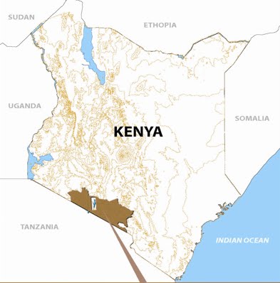
The new South Rift tourism destination, launched by SORALO, offers a unique chance for pastoral communities to lead in conserving one of Africa’s richest vertebrate locations to the benefit of its members. Research can give SORALO the information on wildlife and land potential it needs to plan and manage the South Rift on a profitable and sustainable footing. Yet, despite its relevance to conservation and development, research in East Africa has been done, packaged and delivered by scientists, with little community involvement. Lack of involvement has blind-sides communities on the importance of research to conservation and development and side-lined them in decision-making.

Creating community-based research is as challenging as the creation of community-based conservation, perhaps more so. It will take an equally radical shift in the focus of action and decision from the exclusion to inclusion of communities.  Shifting the focus of action and decision in research calls for grass roots appreciation of science and training in skills to collect, interpret, and use information.  Leveling the playing field in information access for local communities involves drawing on their own time-tested traditional knowledge and providing access to the worldwide web. Only by accessing information locally and globally will local communities be in a position to test and apply knowledge to their own challenges.   

Emergence of Community based Research in the South Rift

Research in the South Rift began in 2000, when ACC set up surveys of wildlife, livestock, and human activity to monitor the success of the Shompole and Olkiramatian Wildlife Sanctuaries. The studies showed a sharp increase in wildebeest, zebra, lion and other wildlife following the creation of the sanctuaries. A new ACC project was set up to encourage and track the inward migration of elephants. The numbers have since risen from a few occasional sightings to herds seasonally exceeding 150 elephants. Community scouts were then hired, trained and deployed to protect the growing wildlife numbers, to address human-wildlife conflicts and to collect information on animal sightings. The success of Shompole and Olkiramatian soon attracted scientists interested in community-based conservation and in the coexistence of people and wildlife outside national parks.

By 2006, research interest in the South Rift, the prospects of a community income from research to compliment ecotourism, and the need for information to guide conservation and development, saw a small permanent campsite established on the south of the Uaso Nyiro Bridge. The site, and the strong link between research community interests, caught the interest of biological expeditions such as Earth Watch and zoo and university groups such as Earth Expeditions.

Activities at the resource centre have grown rapidly in 2008. New ideas for the centre are emerging out of the growing links between researchers and community. So, for example, to complement the work of the wildlife scouts, ACC has trained and deployed seven Community Resource Assessors. The CRAs were selected from local communities and have taken on work ordinarily done by researchers, including ecological monitoring, livelihood surveys and land use assessment. The assessors will collect, collate and analyze data relevant to conservation and development.

Working with resident and visiting scientists and ACC, the centre will develop new tools such as participatory GIS and 3-D landscapes for mapping information and land use planning. In yet another development emerging from the centre, an Olkiramatian member has habituated a nearby troop and conducting “Walking with Baboons” tips for visitors. Other activities such as “Walking with Cattle,” “Traditional Knowledge” walks and evening talks for visitors are planned.

The development of a community resource centre on Olkiramatian has purposely followed an evolutionary approach to exploring and developing research for conservation, ecotourism and development. The step-by-step approach draws communities into research, rather than delivers research to them from scientists. The goal of community-based research is to foster an appreciation of research, a demand for information and the skills and institutions needed to collect and evaluate data reliably. An important starting point was the collection of existing knowledge of the area, its wildlife, people, resources and time-tested production and survival strategies of pastoral societies. This helped build interest and confidence and emphasize the importance of sharing and testing knowledge.

The concept of community-based research to compliment community-based conservation won the support of SORALO at a meeting of 40 representatives held at Magadi on March mmmm. SORALO adopted the concept and gave the go-ahead for Olkiramatian and ACC to draw up an outline proposal for the resource centre, design a communal meeting hall, raise the funds for its construction and submit the final proposal to SORALO when complete. The plans will include setting up communication facilities at the centre to connect to internet and the worldwide web.

Monday, June 21, 2010

SORALO Cattlemen

In the Southern Rift of Kenya pastoralist land is under communal land tenure in the form of Group Ranches. Each Group Ranch has a committee and everyone who is based in the area is a member. Group Ranch boundaries are defined but not fenced and traditionally there is a good deal of collaboration between neighboring Group Ranches, particularly with regard to grazing. Despite this, in the past there was no joint management and planning, which transcended these boundaries and looked to the future of the area as a whole.

Livestock is a key asset in the arid and semi-arid areas of the South Rift region of Kenya. This forms quite a big part of the meat industry suppliers and is estimated to be 80% of the producers. The livelihoods of pastoralists are directly linked to their animals, and thus to the environment in which they live in.

Pastoral communities should capitalize on its livestock wealth by taking advantage of both the opening of KMC and the new markets in Asia, particularly in the affluent and nearby Middle East. This could be key to improving the livelihoods of the pastoral communities by improving the quality of livestock that will compete with other livestock producing areas.

Project Objective

To improve livestock productivity through better breeding and husbandry techniques designed to increase marketable beef outputs without prejudicing traditional efficient drought resilience strategies.

Expected Outputs

o Improved livestock breeds across the South Rift
o Better market outlets and competitive production
o Creation of more grass banks and rangelands rehabilitation

Project Location

The current project location is Iluanat Centre in the Mailwa Group ranch in Kajiado District, some 15km from Namanga town.

Project Programs

o Breeding Stock: This will involve the development of a centre that will produce bulls to be sold to the community at subsidized prices especially targeting large stock farmers who can afford to purchase the bulls and who will not benefit from a pull system due to the size of their herds.

o Bull Camps: For the livestock farmers who are not large stock farmers and have 10 animals or less - which makes up 90% of these communities - a bull camp will be established initially in 5 sites targeting 100 animals each (500 animals) per breeding season. Breeding happens twice a year therefore this program will target 1000 animals per year. Ten breeding bulls will be purchased so that each camp will have two bulls at any one breeding season.

o Livestock Health Program: As farmers improve their herds it will be important to train them in basic livestock management techniques so that they do not lose their stock due to poor disease control and other management practices.

Community Input

The Mailwa community set aside 2 acres of land where the livestock holding ground is located and individual farmers volunteered 600 acres for grazing of the animals for the three years of this first phase of the project. The livestock officer in the area developed a plan for the site and continues to give technical advice. The area was assessed for the breeding program and was found to be viable as the area is close to a community bore hole, an old cattle dip that has been rehabilitated and the grass in the area is of high quality.

Breed Preference

There are two breeds that are tolerant to the hash climatic conditions of the arid and semi- arid areas apart from the Maasai Zebu i.e. the Boran and the Sahiwal cattle. The Sahiwal cattle are both beef and dairy producers unlike the Boran, which is only a beef producer. The communities had a high preference for the Sahiwal breed for this main reason. It is tick-resistant, heat-tolerant and noted for its high resistance to parasites, both internal and external. Cows average 2270 kg of milk during lactation while suckling a calf and much higher milk yields have been recorded. Their color can range from reddish brown through to the more predominant red, with varying amounts of white on the neck, and the underline. In bulls the color darkens towards the extremities, such as the head, legs and tails.

Project sustainability

The breeding stock is estimated to produce 60 liters of milk per breeding season, which will be sold to milk processors and the sale of bulls and old stock will enhance project sustainability.

Eco-Tourism

The South Rift offers a unique opportunity that combines wildlife safaris with eco-tourism through various facilities being developed in the region by the Maasai group ranches.  SORALO intends to facilitate a development agenda, focused on tourism, which will address the threats related to maintaining a wildlife habitat to ensure that the integrity of the ecosystem remains intact, for future generations.


Come visit one of our projects now!

Proposed Education Programs for the South Rift

Given the current environmental challenges facing arid and semi arid areas such as: environmental degradation, climate change, land use changes; children need to be informed sufficiently since they are the future leaders and beneficiaries of their environment.

Proposed Environmental School Activities

o    Formation of environmental clubs
o    Inter school competitions on environmental issues
o    Water and energy preservation and harnessing
o    Use of renewable and green energy
o    Recycling of waste products to reduce pollution and provide an alternative source of energy
o    Environmental re-greening and rangelands rehabilitation program

Information Sharing

Access to computers for pastoralist children is a major challenge.  Their counterparts, who sit for the same exams, have a competitive edge because they start using computers in class one.  Pastoralist children have to look for computer courses after their high school education is complete which can be expensive for parents and delays their entry into the workforce.   The Resource Centre, being the hub of research in the area, will provide training and learning materials to encourage children to visit the centre and interact with researchers and community members.  The centre hopes to gain access to computers, a projector screen, and video equipment, and also improve upon their solar power system to enhance this information-sharing atmosphere.


Supplementary Feeding Program

The last drought caused a lot of schools in the region to close and many children were unable to attend classes due to lack of food both at home and in schools. SORALO would like to establish a dairy goat program for schools to provide milk that could be partly used by the schools, but could also be sold to purchase cereals to feed the children. This program could also be used as a model to look at the quality of the products produced by a single animal rather than keeping too many animals that have less value in terms of production.